![](/images/other/stat-length.png)
![Trail Walking Valkenburg aan de Geul - 2021-07-31_16h24m37_668 (1) - Photo](https://media.geolcdn.com/t/1900/400/068441ca-100f-4e0b-aeb5-ac0dbbad0b2b.jpg&format=pjpeg&maxdim=2)
2021-07-31_16h24m37_668 (1)
mumu.larandonneuse
User GUIDE
![Length](/images/other/stat-length.png)
![Max alt](https://static1.geolcdn.com/siteimages/upload/files/1508320355ic_sort_altitude_max_24dp.png)
![Uphill gradient](https://static1.geolcdn.com/siteimages/upload/files/1508320355ic_sort_den_pos_24dp.png)
![Km-Effort](/images/other/stat-length.png)
![Min alt](https://static1.geolcdn.com/siteimages/upload/files/1508320355ic_sort_altitude_min_24dp.png)
![Downhill gradient](https://static1.geolcdn.com/siteimages/upload/files/1508320355ic_sort_den_neg_24dp.png)
![Boucle](https://static1.geolcdn.com/siteimages/upload/files/16400158638029165_repeat_loop_refresh_sync_direction_icon.png)
![Walking](https://static1.geolcdn.com/sitytour/trail-icons/101.png)
3h37
Difficulty : Easy
![Scan this QR Code to open this trail in the SityTrail application](https://capi.geolives.com/qq0zvz2zws4bq2lad0pu/sitytour/trails/2880324/qr.png?size=200)
FREE GPS app for hiking
About
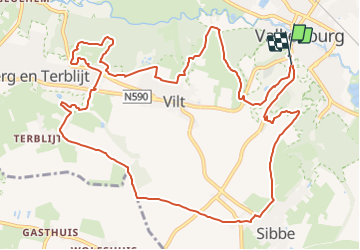
Trail Walking of 13.2 km to be discovered at Limburg, Unknown, Valkenburg aan de Geul. This trail is proposed by mumu.larandonneuse.
Description
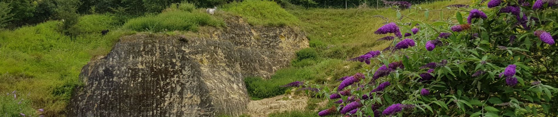
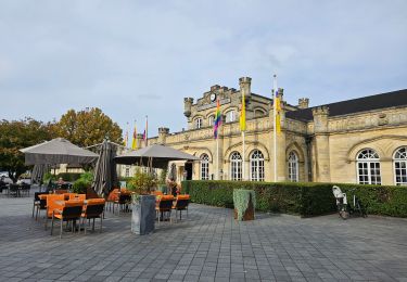
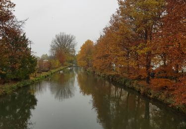
🇳🇱 Cette promenade vallonnée commence par une montée vers Vilt, jusqu'au Groeve Meertens (et ses chèvres) et la Bergse Heide, puis une belle boucle à travers la réserve naturelle de Langen Akker, un joli tour à travers le Groeve Blom (avec chèvres, moutons et cochons en liberté), Terblijt, la traversée d'un magnifique plateau jusqu'à Sibbe puis le retour par une route panoramique tranquille jusqu'à Valkenburg et ses grottes.
📌 Au pied du Cauberg à Valkenburg.
ℹ Gpx pris sur www.wandelgidszuidlimburg.com n° 668.
Positioning
Comments
Trails nearby
![Trail Walking Valkenburg aan de Geul - 🚂 Valkenburg à 🚂 Maastricht par Via Belgica - Photo](https://media.geolcdn.com/t/375/260/cdced05f-f774-4cf2-bb15-fe4c48e907c6.jpg&format=jpg&maxdim=2)
![Walking Walking](https://static1.geolcdn.com/sitytour/trail-icons/101.png)
Walking
![](/images/other/stat-length.png)
![](https://static1.geolcdn.com/siteimages/upload/files/16400158638029165_repeat_loop_refresh_sync_direction_icon.png)
![Trail Walking Valkenburg aan de Geul - 🎅🎄 Valkenburg - Photo](https://media.geolcdn.com/t/375/260/c3fac4ca-18c6-41ea-bd7c-d2a8e36eb914.jpg&format=jpg&maxdim=2)
![Walking Walking](https://static1.geolcdn.com/sitytour/trail-icons/101.png)
Walking
![](/images/other/stat-length.png)
![](https://static1.geolcdn.com/siteimages/upload/files/16400158638029165_repeat_loop_refresh_sync_direction_icon.png)
![Trail Walking Valkenburg aan de Geul - 2023-11-10_18h36m23_1730.gpx.xml - Photo](https://media.geolcdn.com/t/375/260/0c5632d6-fa7c-4b28-afdd-a11c00242503.jpg&format=jpg&maxdim=2)
![Walking Walking](https://static1.geolcdn.com/sitytour/trail-icons/101.png)
Walking
![](/images/other/stat-length.png)
![](https://static1.geolcdn.com/siteimages/upload/files/16400158638029165_repeat_loop_refresh_sync_direction_icon.png)
![Trail Walking Valkenburg aan de Geul - 2023-08-29_11h45m24_route-des-vins-berg-en-terblijt--houthem-st-gerlach-vi6 - Photo](https://media.geolcdn.com/t/375/260/852c106e-818c-4548-acc4-e956e65bf915.jpg&format=jpg&maxdim=2)
![Walking Walking](https://static1.geolcdn.com/sitytour/trail-icons/101.png)
Walking
![](/images/other/stat-length.png)
![](https://static1.geolcdn.com/siteimages/upload/files/16400158638029165_repeat_loop_refresh_sync_direction_icon.png)
![Trail Walking Valkenburg aan de Geul - Sibbe - Valkenburg 🎄🎅 - Photo](https://media.geolcdn.com/t/375/260/635f6fea-be0e-416f-bbe0-3fc5facaae54.jpg&format=jpg&maxdim=2)
![Walking Walking](https://static1.geolcdn.com/sitytour/trail-icons/101.png)
Walking
![](/images/other/stat-length.png)
![](https://static1.geolcdn.com/siteimages/upload/files/16400158638029165_repeat_loop_refresh_sync_direction_icon.png)
![Trail Walking Valkenburg aan de Geul - 2022-11-11_17h59m47_hoogtewandeling-valkenburg-aan-de-geul - Photo](https://media.geolcdn.com/t/375/260/17d77ae4-7009-4034-91af-70d2fca6ac04.jpg&format=jpg&maxdim=2)
![Walking Walking](https://static1.geolcdn.com/sitytour/trail-icons/101.png)
Walking
![](/images/other/stat-length.png)
![](https://static1.geolcdn.com/siteimages/upload/files/16400158638029165_repeat_loop_refresh_sync_direction_icon.png)
![Trail Walking Gulpen-Wittem - 2021-10-27_20h47m33_1105 - Photo](https://media.geolcdn.com/t/375/260/115742d6-93f7-467f-9808-8e4bc3de0870.jpg&format=jpg&maxdim=2)
![Walking Walking](https://static1.geolcdn.com/sitytour/trail-icons/101.png)
Walking
![](/images/other/stat-length.png)
![](https://static1.geolcdn.com/siteimages/upload/files/16400158638029165_repeat_loop_refresh_sync_direction_icon.png)
![Trail Walking Valkenburg aan de Geul - geulpark-en-kasteel-oost-va2-valkenburg-aan-de-geul - Photo](https://media.geolcdn.com/t/375/260/826a5cdc-cfc5-40c0-aa94-21dd8ba3e11f.jpeg&format=jpg&maxdim=2)
![Walking Walking](https://static1.geolcdn.com/sitytour/trail-icons/101.png)
Walking
![](/images/other/stat-length.png)
![](https://static1.geolcdn.com/siteimages/upload/files/16400158638029165_repeat_loop_refresh_sync_direction_icon.png)
![Trail Walking Gulpen-Wittem - 2022-06-10_16h45m42_1555 - Photo](https://media.geolcdn.com/t/375/260/ext.jpg?maxdim=2&url=https%3A%2F%2Fstatic1.geolcdn.com%2Fsiteimages%2Fupload%2Ffiles%2F1553511878bg_sport_marche.png)
![Walking Walking](https://static1.geolcdn.com/sitytour/trail-icons/101.png)
Walking
![](/images/other/stat-length.png)
![](https://static1.geolcdn.com/siteimages/upload/files/16400158638029165_repeat_loop_refresh_sync_direction_icon.png)
diversifiée